FOREWORD
In this new millennium, we marked our involvement in the development of geophysical technology. FKS Global Services are relatively young surveying company and we are dedicated to the profession of the Underground Utility Detection & Mapping Services.
Our ambition is to fulfil our services as a company with commitment. We’re to offer our services to clients towards the seamless planning and execution of project, protecting employees and avoiding costly legal action.
Not only to fulfil local authority requirement, will our service keeps you and your neighbourhood safe. We at FKS Global Service have developed our strength and expertise in this industry particularly in the field of underground mapping services.
We are pleased to offer following services:
Licensed Surveyor Work
Underground Utilities Mapping
Aerial Photography
Topography Survey
The benefits of using FKS Global Service underground mapping services:
Over 2 years’ experience members.
Independent service provider.
Comprehensive skills in the industry.
The above services highlight of comprehensive overview of technical capabilities and project deliveries by FKS Global Services.
ABOUT US
FKS Global Services providing Aerial Photography, Topography Survey, Global Navigation Satellite System Positioning and Advance Underground Detection.
Our main aim is to cater for the increasing demand for the latest geographical data at the least possible cost to the customers.
FKS Global Service tried to maintains an excellent reputation for providing individualized, attentive one-stop solution of the highest quality at competitive rates.
Such success is built upon its collaborative relationships with customers and business partners, committed employees, responsiveness, flexibility and capabilities.
It is our aspiration to be the committed company in the field.

Company’s Quality Policies
For Quality, FKS Global Services shall provide
the best knowledge of equipment technology to all team.
All members to give their best on all task,
for company committed with the best quality.
Company’s Quality Objectives
Accurate information regarding the existing underground utilities is required in the planning, installation of new utilities and excavation of existing utilities. Lack of knowledge on this may result in fatality and catastrophic damages of existing underground utilities and disruption to utility services. Industries may suffer greatly, in terms of financial lost if utility services such as power supplies are interrupted because of accidents during excavation works due to inaccurate utility information.
Our objectives are to provide consistent product quality improvement and cost reduction so as to provide our customer with the best-valued product.
In doing so, it is also the objective of FKS Global Service to achieve zero defects in its product in order to gain customer’s respect.
It is our aspiration to be the committed company in the field by providing the latest and the best knowledge of the equipment we used for the team as they will gain more skill for completing their task professionally.
We shall also comply with all laws and regulations for completing the task given.
Scope of Services
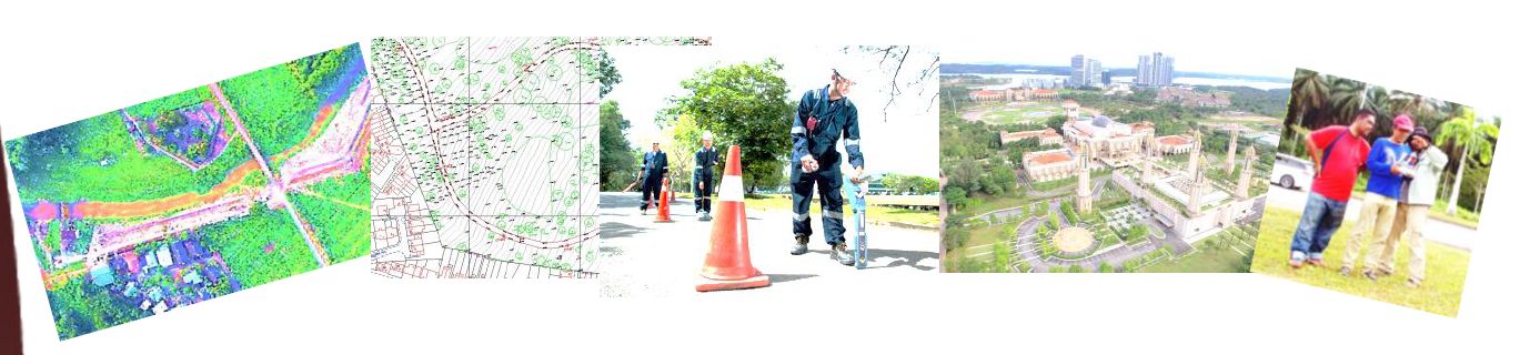
Advance Underground Utility Mapping
Underground utility mapping refers to the detection, positioning and identification of buried pipes and cables beneath the ground. It deals with features mainly invisible to the naked eyes.
While the determination of position can be obtained with conventional or modern survey equipment, the detection and identification of underground utilities require special tools and techniques. Principally, underground utility mapping is the combination or marriage between two major fields of knowledge namely; geophysics and geomatics.
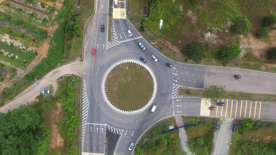
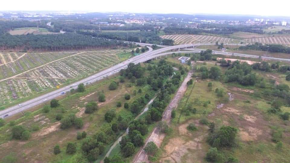
Aerial Survey Services
Aerial Photographic surveys are used to help identify the general topography of the area of investigation before one engages the field survey units. It is also used now to gather the latest ground information. Photo mosaics produced help identify routes for new highways, transmission lines, gas pipe lines etc. This method can ensure that the designed route will not pass over residential areas, sites of sensitive nature such as cemeteries, schools and historical sites. Aerial Photographic will only be cost effective if the area of coverage is very large.

WORKING EXPERIENCE
1. Underground Utility Mapping, Bakri Road Muar, Johor (JKR)
2. Underground Utility Mapping, Terus Road Johor
3. Underground Education Hub Mapping, Pagoh Muar
4. Underground Utility Mapping, Aeon Tebrau Johor (SAJ)
5. Underground Utility Mapping, Kg Pendas Gelang Patah (JUPAN)
6. Underground Utility Mapping, Pengerang As-Built (JKR)
Contact Us
En Faiz - 016 4413975
En Nizam - 013 2118650
En Fairuz - 019 7315004